By Raven Visser
on February 19, 2021
· How-To

The parcel data made available by counties across the US varies widely in how land use is classified (if that information is available at all). Our standardized land use codes describe each parcel across five dimensions (Activity, Function, Structure, Site, and Ownership). These codes are 4-digit numbers, with the first digit denoting the broadest category, and each successive digit describing the parcel in more detail. For example, in the Activity dimension:
-
An Activity code of 3000 means 'Industrial, manufacturing, and waste-related activities'.
-
An Activity code of 3100 has one more digit of detail--it still falls under the above description, but it refers to 'Plant, factory, or heavy goods storage or handling activities'.
-
An Activity code of 3120 means 'Primarily goods storage or handling activities'--still industrial in nature, and related to plant, factory, or heavy goods storage or handling, but much more specific!
In the image below, where codes are indented to show their hierarchy, you can see how an Activity code of 3120 is just one of several different codes (e.g. 3110, 3120, 3210, 3220, 3230) at the same level of specificity (three digits):

When you expand this potential for specificity across five dimensions, each intended to describe an aspect of the land use for a particular parcel, you can see how useful Loveland's standardized land use codes can be to identify land used for general or specific purposes.
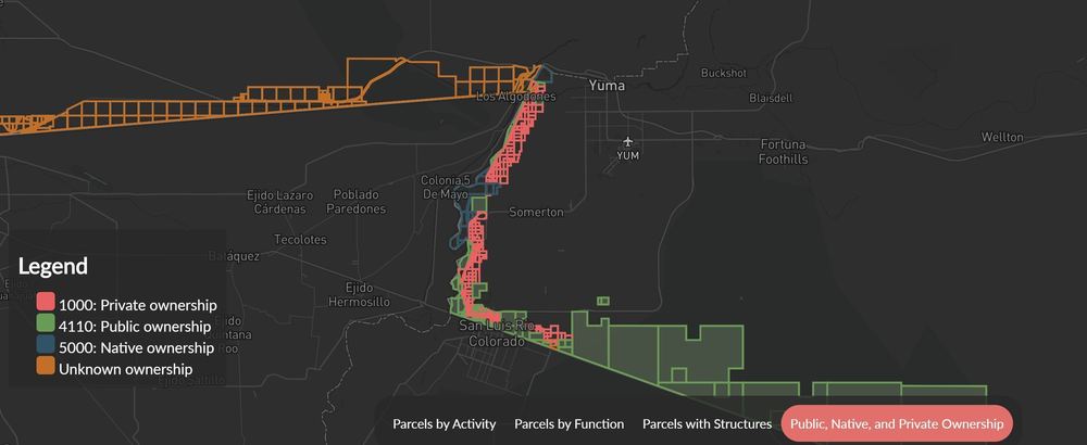
Our standardized land use codes are derived from the Land-Based Classification System (LBCS), a method devised by the American Planning Association. Activity describes the actual human activities that take place on the parcel, while Function describes the broader economic or social use the parcel serves. Structure and Site describe the type of structure on a parcel and, independently, whether the parcel is developed or not. Ownership describes whether the owner of the parcel is a public or private entity.
The five-dimension approach gives a sense of what is actually there for any given parcel, and we fill as many of the five dimensions as we can when we apply our standardized land use codes. This work is done manually, county by county, matching each place's assessor-provided land use information (where available) to the applicable codes for each dimension. For example, a parcel that is used as a parking lot for a public school would be encoded like this using our system:
-
Activity: 5210 (Vehicular parking, storage, etc.)
-
Function: 6100 (Educational services)
-
Structure: 5200 (Automobile parking facilities)
-
Site: 5300 (Developed site with roads, train tracks, and other linear structures)
-
Ownership: 6100 (Nonprofit educational)
Whereas, in a traditional single-dimension system, a choice would have to be made between classifying that same school parking lot as simply "parking" or "educational", or possibly even just "public property".
Currently, in the top 50 metro areas in the country, over 80% of parcels have codes for Activity and Function, and over 60% have codes for Structure and Site. In Loveland's entire nationwide dataset of more than 147 million parcels, two-thirds of all parcels have a standardized land use code for Activity and Function. We continually add new places and fill in codes for existing ones. You can stay up to date on which places have standardized land use codes using our coverage report.
In addition to the standardized land use codes, our data also includes human-readable '_description' fields for each dimension. To use the same example from earlier, an 'lbcs_activity' value of 3120 would have an 'lbcs_activity_description' value of 'Primarily goods storage or handling'. We keep the standardized land use codes and text descriptions separate to allow for easier processing and sorting of our data.
Users of Loveland's data and the mapping platform can perform queries to find patterns across the dataset, or to count certain types of parcels. Our Border Parcels project shows how our standardized land use codes can be used to generate insights into how land is used across areas of interest that span multiple states and counties, each of which provided entirely separate and incompatible land use data.
Likewise, finding and mapping all the residential parcels in a city could help with understanding and tracking the spread of disease outbreaks like the current COVID-19 pandemic. If you are a local government or a fellow mapping and data company that could use parcel data to push forward your study, outreach efforts and research on COVID-19, or if you have questions about LBCS in general, please contact us at team@landgrid.com, or check out the parcel data FAQ.
Happy Mapping!
Ray Visser
ray@landgrid.com
Loveland Data Team
313-649-LAND
By Sahana Murthy
on February 9, 2021
· Announcements

Dear Friends of Loveland Parcel Data and landgrid.com,
A summary of updates in January of 2021 and the upcoming pipeline is below.
Key Data Stats:
- Average parcel age - 198 days, down from 205 last month.
- Average county age - 275 days, down from 277 last month.
- Added 34,000 parcels and refreshed 252 counties since last month.
USPS Vacancy, Residential indicators: Now updated monthly. Updated in January 2021, next update in February.
Coverage Report: Updated for this month and available here:
https://docs.google.com/spreadsheets/d/1q0PZB72nO8935EMGmsh3864VjEAMUE-pdHcPkoAiS5c/
For all full dataset customers, the updated data is available for download to bulk data clients in these formats: GeoPKG .gpkg (suggested), GeoJSON, Shapefile, and Postgres SQL files. In addition, this data has been updated on the landgrid.com website.
If your organization uses a custom export we are updating your data at the moment and if you don’t see the latest updates, please drop us a line.
A Data Dictionary for the Loveland Standard Schema is always available here:
https://docs.google.com/spreadsheets/d/14RcBKyiEGa7q-SR0rFnDHVcovb9uegPJ3sfb3WlNPc0/
A machine-readable version of this list is included in the `verse` table available in all the formats above as well as CSV format for use in spreadsheets. To find the latest updates in verse, sort by 'last_refresh' and use the 'filename_stem' column to identify the file.
Data refreshed or added from the county in January and live now:
( Asterisk * indicates newly added county)
--------------------------------------------------
Arizona - Maricopa
Colorado - Costilla
Illinois - Cook
Mississippi - Clay, Warren
North Carolina - Alamance, Alexander, Alleghany, Anson, Ashe, Avery, Beaufort, Bertie, Bladen, Brunswick, Buncombe, Burke, Cabarrus, Caldwell, Camden, Carteret, Caswell, Catawba, Chatham, Cherokee, Chowan, Clay, Cleveland, Columbus, Craven, Cumberland, Currituck, Dare, Davidson, Davie, Duplin, Durham, Edgecombe, Forsyth, Franklin, Gaston, Gates, Graham, Granville, Greene, Guilford, Halifax, Harnett, Haywood, Henderson, Hertford, Hoke, Hyde, Iredell, Jackson, Johnston, Jones, Lee, Lenoir, Lincoln, Macon, Madison, Martin, McDowell, Mecklenburg, Mitchell, Montgomery, Moore, Nash, New Hanover, Northampton, Onslow, Orange, Pamlico, Pasquotank, Pender, Perquimans, Person, Pitt, Polk, Randolph, Richmond, Robeson, Rockingham, Rowan, Rutherford, Sampson, Scotland, Stanly, Stokes, Surry, Swain, Transylvania, Tyrrell, Union, Vance, Wake, Warren, Washington, Watauga, Wayne, Wilkes, Wilson, Yadkin, Yancey
Nevada - Clark
Oregon - Baker, Clackamas, Clatsop, Columbia, Coos, Crook, Curry, Deschutes, Douglas, Gilliam, Grant, Harney, Hood River, Jackson, Jefferson, Josephine, Klamath, Lake, Lane, Lincoln, Linn, Malheur, Marion, Multnomah, Polk, Tillamook, Wasco, Wheeler, Yamhill
Texas - Hamilton
Washington - Adams, Asotin, Benton, Chelan, Clallam, Clark, Columbia, Cowlitz, Douglas, Ferry, Franklin, Garfield, Grant, Grays Harbor, Island, Jefferson, King, Kitsap, Kittitas, Klickitat, Lewis, Lincoln, Mason, Okanogan, Pacific, Pend Oreille, Pierce, San Juan, Skagit, Skamania, Snohomish, Spokane, Stevens, Thurston, Wahkiakum, Walla Walla, Whatcom, Yakima
Wisconsin - Milwaukee
West Virginia - Barbour, Berkeley, Boone, Braxton, Brooke, Cabell, Calhoun, Clay, Doddridge, Fayette, Gilmer, Grant, Greenbrier, Hampshire, Hancock, Hardy, Harrison, Jackson, Jefferson, Kanawha, Lewis, Lincoln, Logan, Marion, Marshall, Mason, McDowell, Mercer, Mineral, Mingo, Monongalia, Monroe, Morgan, Nicholas, Ohio, Pendleton, Pleasants, Pocahontas, Preston, Putnam, Raleigh, Randolph, Ritchie, Roane, Summers, Taylor, Tucker, Tyler, Upshur, Wayne, Webster, Wetzel, Wirt, Wood, Wyoming
Wyoming - Albany, Big Horn, Campbell, Carbon, Converse, Crook, Fremont, Goshen, Hot Springs, Johnson, Laramie, Lincoln, Natrona, Niobrara, Park, Platte, Sheridan, Sublette, Sweetwater, Teton, Uinta, Washakie, Weston
In the current pipeline for updating in February 2021
--------------------------------------------------
Nebraska
Pennsylvania
Oklahoma
Hawaii
In the pipeline for updating in March 2021
--------------------------------------------------
Alaska
Indiana
Michigan
Vermont
Based on feedback and county challenges, pipeline planning is always subject to change. As always, please contact us if you have any questions about accessing or using the data, you find issues with any of our data, or you have any comments or questions about our data in specific areas or states. We also love to hear from you about which counties or regions you’d like to see us update next, as it helps inform our planning process.
Thank you for being a part of Loveland!
Happy Mapping!
Blake Girardot
blake@landgrid.com
Loveland Data Team
313-649-LAND
By Sahana Murthy
on January 21, 2021
· Announcements

Happy New Year, all.
Sharing a short video that visualizes 8 years of land data growth in 75 seconds; a reminder that it’s easy to reach out to the Loveland team any time, and, just because it’s the season, some winter pics from the snowy north.
Our co-founder and CTO, Larry Sheradon, recently blew my mind when he made this short time-lapse of our nationwide dataset growing by the day from 2013 through the present: https://youtu.be/rfgh7aqRx7I

Our whole job at Loveland is to make it easy for you to access and work with this land and property information. As a refresher, we can do that for you in a variety of complimentary ways:
We try to lay it all out neatly at landgrid.com, but with so many options and so much data, you can always reach us at team@landgrid.com to tell us what you’re looking for or trying to accomplish and we’ll get back to you within a day to help you find the right solution.
And while I’m here, since we’re smack dab in the middle of winter, I can’t not share some views of what it looks like in Michigan’s Upper Peninsula right now.
The Loveland team is spread out across the country, but this is the current view through the window of our home office in Calumet, where Mary and I have relocated full-time from Detroit since March, trading skyscrapers for frozen stalactites — a different, but equally inspiring view:

This is “pancake ice” on Lake Superior, the largest freshwater lake on earth (well, largest by surface area — there’s a deeper one in Russia that’s smaller on the surface, but has more volume… I’ll still give it to Superior, though):

This is the glow of lights in town bouncing off low-flying lake effect clouds in a light snow on a cross-country ski trail:

This is new-fallen snow on a freshly groomed trail — getting outdoors and skiing has become my go-to way to unplug and recharge outdoors in winter:

This is an ice formation on a frozen, rocky beachscape — my rock picking is basically on pause until spring at this point, though I’ve got a couple of rock tumblers going around the clock in the garage:

I’ve got too many of these pictures, so I’ll stop there, but the landscape is amazing, and land is more than data about land, so I wanted to share. Depending on where you are in the world, I hope you’re still finding joy in the seasons and the outdoors if you’re experiencing short, cold, gray days. Hang in there.
Watch out for more exciting product updates coming from the Loveland team this year. The products are already outstanding, but we’re not resting on our laurels.
Stay safe, stay healthy, and stay connected to the land,
Happy Mapping!
Jerry Paffendorf
team@landgrid.com
313-649-LAND


.svg)


