-
Enterprise
 Premium Parcels
 Roadway ROW
- Data Store
- Regrid App
- Esri Users
-
Resources
 Support
 Content
 Programs
.png) Shop
Shop
- Contact Us
- Hide Menu


Custom GIS & Data Solutions
Landgrid's goal is to make property data useful and accessible for our clients, bridging gaps and connecting the dots. Sometimes it takes custom work to get from A to B!
Our team has expertise you can trust to get the most from your data. Does your county Assessor provide daily parcel updates? We can hook those into our site so you see the freshest data. What if you're already working with a database provider?
Great! We can use an API to connect with them, so that you can visualize everything you're working on in a map and get insights in a flash.
Have a bunch of spreadsheets sitting around with customer information? No problem! We can get that imported for you, so that you can see where your strongest markets are for more targeted outreach.
Email us at enterprise@landgrid.com to discuss further.
Custom data integration
We can integrate our data with your property data. Leave it to the Landgrid team to clean, standardize & add your datasets onto the Landgrid Mapping Platform.
Data analysis
If you know the insight you need, but not how to get there, we can help - both with thinking through how to surface the most useful statistics, as well as with the actual number-crunching itself.
Custom stats
Custom reports
If you'd like a report that polishes up and showcases your data/findings, we can help with that too. See some examples of past work here.
What it costs:
$2,500 & upwards of one-time costs for the custom work, depending on the scope of work & depth of customization. Plus a base Enterprise account for ongoing maintenance and support.

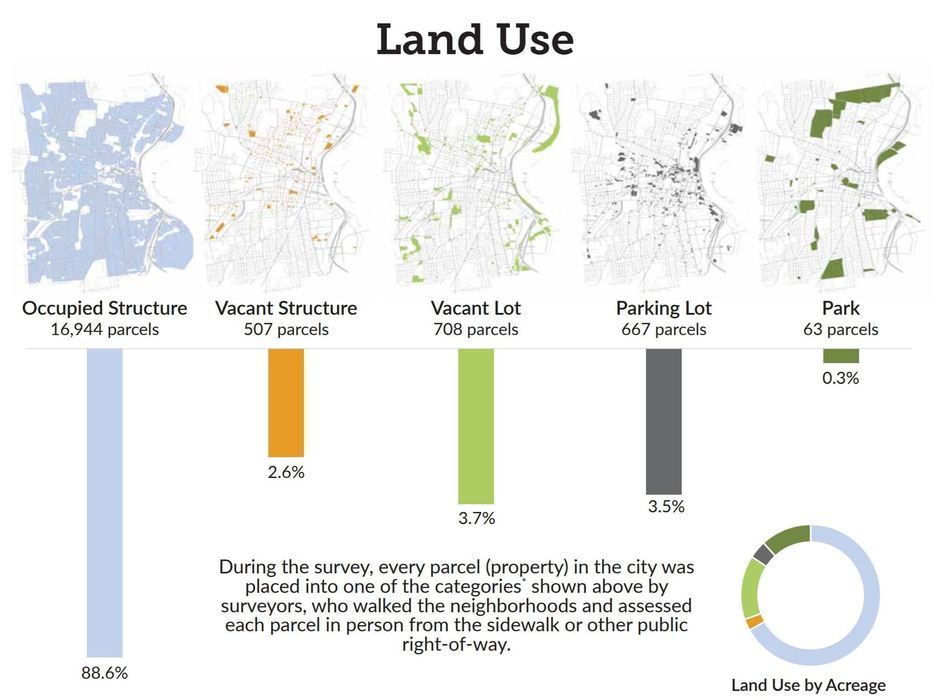
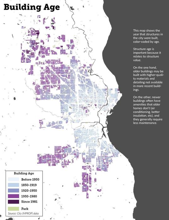
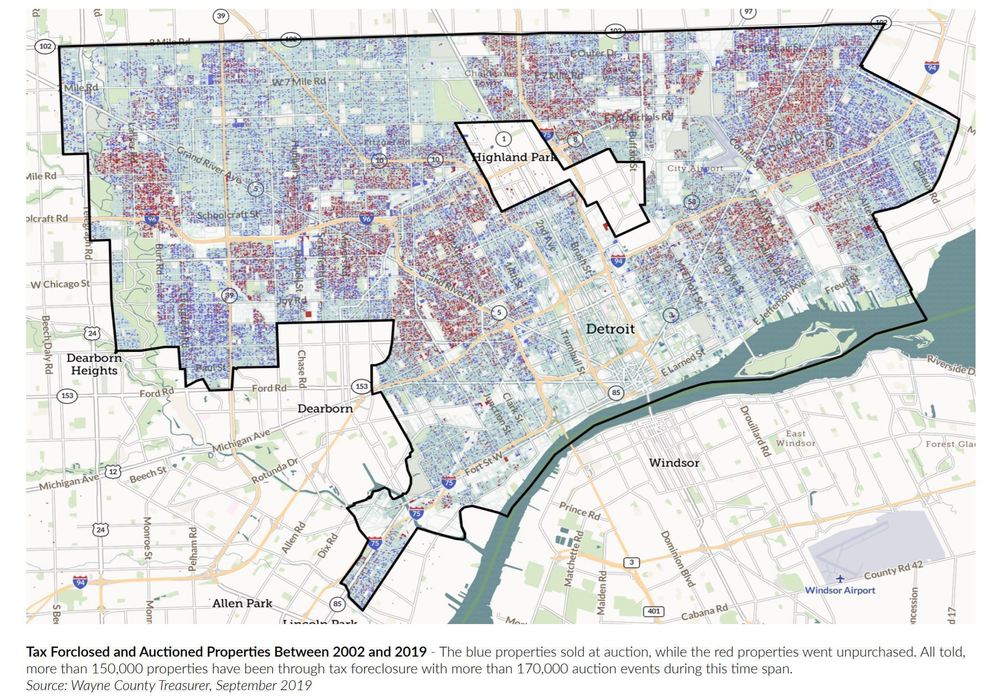
LISC Milwaukee County data integration
LISC Milwaukee has an Enterprise account so that they can provide group accounts to partners in the city. In order for everyone to have the most current property data, we hooked up their city's dataset for automatic, daily updates that all can use.
View more case studiesLet us know how we can help you!
If you have a GIS project in mind that needs some custom mapping work or data integration, then please let us know how to reach you by filling the form below. We will be sure to reach back to you and set up a time to discuss your requirements further.