By Sahana Murthy
on August 5, 2020
· Announcements

We are gearing up for a few product announcements coming up later in August and September.
So we are going to keep our August update fairly short. :)
Digging in:
1. Statewide Georgia Data:
We are happy to announce that we now have parcel data for all of Georgia state. If you are looking for statewide GA, please reach out to us at parcels@landgrid.com. While we had some of GA until now, being able to add the rest of the state has surely been a major milestone for us.
If you are looking for individual counties in GA, then the Landgrid data store would be the place to do to for instant downloads of county data in the format of you choice - https://landgrid.com/store/us/ga
It wasn't just GA that we updated, we recently improved and increased our coverage in MI, ND and are soon looking to add the missing counties in OK as well.
We are working our way towards reaching complete nationwide data coverage, hopefully by the end of 2020. :)
2. Upcoming Product Announcements:
Landgrid Data API & Tileserver - Self-serve SaaS subscriptions
We recently launched our raster & vector Tileserver as its own stand alone product. Thank you to those who reached out asking for more information on it. We are currently working on making our API & Tileserver subscriptions entirely self-serve like our other SaaS subs - the Data Store and the Landgrid Pro & Team subs. Soon you will be able to pick and choose the API subscription tier that suits your needs best and be on your way to using our API and/or tiles instantly, without any delays.
Stay tuned, the launch is coming soon.
Landgrid Pro & Bookmarking on the Landgrid mobile App
We are bulking up our Landgrid mobile app with a comprehensive set of new features.
Soon, you will be able to sign up and use Landgrid Pro straight out of the app and use the same login for the web version as well. Not just that, we are bringing some of our most killer features, including bookmarking properties to the mobile app.
So you will not only be able to look up properties on the go, but you will be able to bookmark them, add notes to your favorite properties and even take pics of properties that are of most interest to you on the app.
The list doesn’t just stop there. You will soon be able to manage & work on surveys straight out of the app too, along with enjoying some of our pro map layers like buildings footprints & more.
Phew--- Now that’s a big product update! So, stay tuned, the launch is coming soon.
3. Upcoming Webcast:
We have an amazing webcast coming up this Friday, August 7th at 3 PM with Kevin Ehrman-Solberg from Mapping Prejudice, an organization that has been doing amazing work mapping racial covenants (restrictions written into deeds that barred non-whites from purchasing the property) and their impacts in Minneapolis and beyond.
Join us live as we sit down to chat with Kevin about racial covenants, data & how crowdsourcing has been critical to gathering this data. We're big fans of Mapping Prejudice here at Loveland, and we encourage all of you to join in and participate.
Register at this link to save your spot for the webinar - https://www.crowdcast.io/e/a-chat-with-mapping

In addition to talking about Mapping Prejudice's innovative work crowdsourcing data on racial covenants in Minneapolis, we'll discuss how data has historically been used both as a vehicle for and an ally against racism over time, what currently available data indicates about the state of the nation, as well as what the future may hold.
That’s it from us for now. Please be on the lookout for some launch emails & communications from us.
Until then, enjoy the rest of your summer.
Please stay safe & well and as always, feel free to reach out to us at team@landgrid.com for all parcel data & mapping information. Or to just say “hi” :)
Happy Mapping!
Team Loveland
http://landgrid.com
team@landgrid.com
313-649-LAND
By Sahana Murthy
on July 9, 2020
· Announcements
Hope you all had a nice, long 4th of July weekend.
We are back with some updates for you on this hot summer day!
1. Launching the Landgrid Tileserver: Make beautiful maps with our raster & vector tiles.
Use our raster (PNG) and vector (MVT) tiles to show parcel boundaries on your Leaflet, Mapbox, or ESRI baselayer. Our tiles come with parcel polygons and the identifiers you need to look up additional details with our search API.
This is the same service we use across our platform and mobile apps, ready for use at scale in your tools. We keep it up-to-date with the latest parcel updates so your clients always see the freshest data.
If you are interested in using our Tileserver, please email us at parcels@landgrid.com and we can set you up in no time.
You can learn about the pricing tiers and limits for our tileserver here -
https://landgrid.com/tiles
We will soon make this a self-serve subscription so you pick & choose the tier you want and sign up for it and get instant access to our tiles.
2. API usage limits:
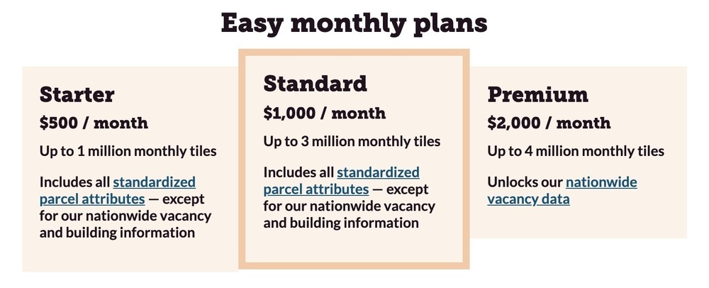
We are introducing new limits on the API tiers, based more on the output than number of requests. We didn’t want to limit API calls or requests for our customers. However, we do have generous output limits now in place for the three API tiers as shown below.
https://landgrid.com/parcel-api
3. Updated Parcels page:
We recently gave our parcel bulk data page a little spruce up. It was due for an update. You know why??? Because our parcel data has gotten bigger, better, and robust in the past year as you may have noticed from our monthly data stats and updates. :)
Check it out - https://landgrid.com/parcels
We want to showcase more of our customers on this page. Let us know if you are interested in telling your Landgrid data story by emailing us at team@landgrid.com.
We want to celebrate your work , product & project.
4. Podcasts and webcasts:
If you have been following us and our content, then you probably know that we have been pretty busy making interesting videos, webcasts and featured podcasts. Here’s the list of some of our most recent podcasts:
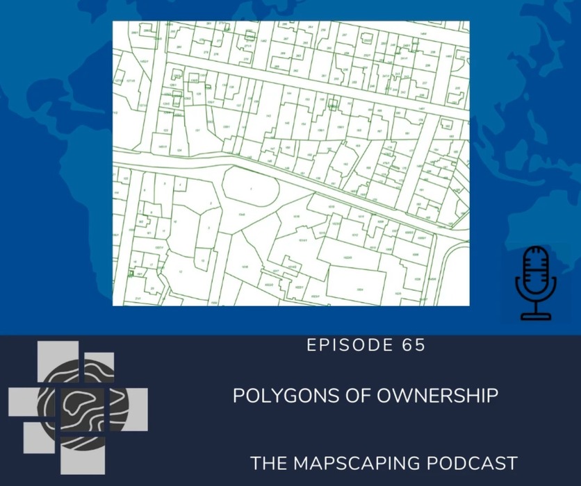
1. Polygons of Ownership - The Mapscaping Podcast
Mapscaping recently featured our CEO - Jerry Paffendorf on their podcast where they discussed parcel data and how our land is divided and sub-divided into polygons.
Catch the full podcast and interview here - https://mapscaping.com/blogs/the-mapscaping-podcast/polygons-of-ownership
Android - https://buff.ly/2O3kuH5
Apple: https://buff.ly/2X6nMNW
Spotify: https://buff.ly/2X7Ym2k
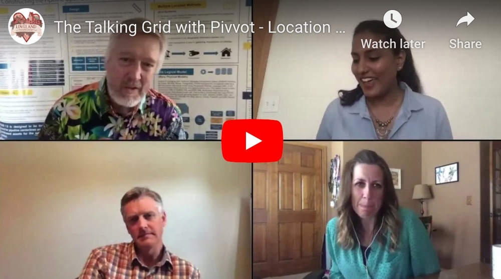
2. The Talking Grid with Pivvot - Location with Context
We recently hosted the the amazing team of Pivvot on our webcast. Catch this fun conversation about Pivvot, data, data trends & COVID on our Youtube channel and website.
That was the July update folks.
Exciting things are coming soon this quarter, so stay tuned with us.
As always, please feel free to email us at team@landgrid.com if you have any questions or would like to discuss an idea with us. We are always available to chat.
Until next time, have a wonderful rest of your July.
Happy Mapping!
By Sahana Murthy
on June 10, 2020
· Announcements
Just like that, we are at the halfway mark of a year defined by world-changing events from COVID-19 to massive demonstrations against racial injustice, and there are still six months and a US Presidential election left in 2020.
With all the intensity and uncertainty in the world, we are keeping the June update short & sweet, though please know that if our data can help you with COVID research or efforts to root out injustice in property policies you should reach out to talk (we are members of the *SafeGraph COVID-19 Data Consortium* and working on reforms to issues like * Detroit’s destructive tax foreclosure policies* remains an abiding interest as it has for years).
Let’s dive right into it then:
Product Updates:
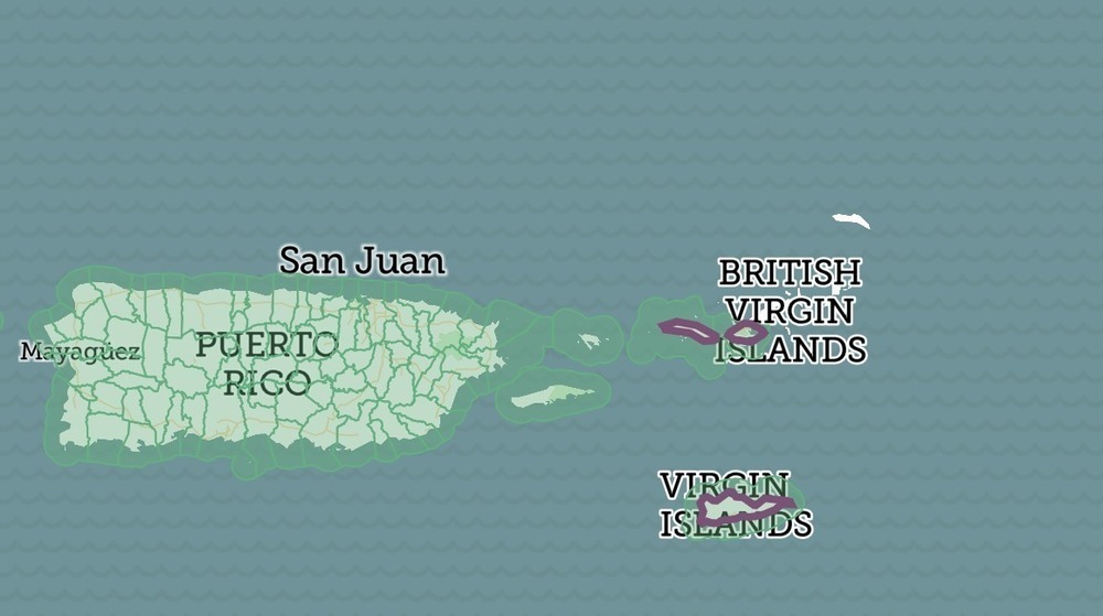
3. US Virgin Islands - We were finally & magically able to add US virgin islands parcel data to our dataset, mapping platform and the data store. We added updated Puerto Rico data too last month. Lots more of the missing counties in our dataset will be coming soon. You can check out the US Virgin Islands on our data store if you are interested - https://landgrid.com/store/us/vi
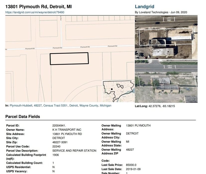
2. Print PDF for Landgrid Pro - We recently added the “Print PDF Map” & "Print Parcel" feature to our Landgrid Pro subscription tier. So all Landgrid Pro users can now not only look up individual parcel information but can also print parcel info as a PDF & print the map you are viewing as well.
Not using Landgrid Pro yet? You can sign up here - https://landgrid.com/plans
3. Upcoming updates - We have a lot of things brewing currently. So stay tuned with us for updates on our:
- Landgrid Mobile App
- Landgrid Tileserver
- Key partnerships
And… Much more!
Content Updates:
We have been keeping good on our promise to you for 2020 - more tutorials and product content. Here’s what’s coming next and what we published recently:
The Talking Grid Webcasts:
1. CARTO & Data with Javier Pérez Trufero We had an amazing webcast last week with CARTO’s Head of Data - Javier Pérez Trufero about all things CARTO, location data & its relevance during COVID-19 and much much more.
Watch the full episode here - https://youtu.be/RO6Mz29TIwk
2. Upcoming - A live “The Talking Grid” webcast with our customers at Pivvot on June 26th - Register to save your spot here - https://www.crowdcast.io/e/meet-pivvot---location
Pivvot has curated a massive database of environmental, land, social and other location information – and we make it easy to access, interpret and share. Used by engineering firms, energy and transportation companies, we turn data into insights by delivering preferred routes, navigating regulatory and environmental issues, reducing risk, and providing detailed location-based awareness.

Webcasts & podcasts:
It’s podcast & webcast season at LOVELAND. We have a host of amazing events lined up for you.
1. CEO, Jerry Paffendorf recently joined the wonderful folks at Dynamo Metrics on their hosted podcast - “Ahead of the curve” - Listen to the fin conversation where Jerry talks about the history of parcels, the fight against blight in Detroit and the current state of the world and the company - https://www.dynamometrics.com/ahead-of-the-curve-podcast/episode-6-jerry-paffendorf
2. Upcoming - Listen to Jerry’s wise words on the Mapscaping podcast later this month. The link will be shared as soon as the podcast's schedule is made available to us.
People of Landgrid:
Lastly, we will leave you with 2 incredible journeys & stories with our People of Landgrid articles -
1. Michele Oberholtzer - Director of Tax Foreclosure Prevention at UCHC, in our latest POL story. A former Lovelander and now an activist for tax foreclosure prevention! A truly inspiring story. https://landgrid.com/pages/michele-oberholtzer

2. Anne Wistow & Stephanie Shackelford - Lucas County Land Bank, Toledo, OH
Anne is the VP of projects planning and Stephanie is the projects manager at the LCLB and together their mission is to strengthen neighborhoods and preserve property values. It's wonderful to see the work they have done in Toledo and the impact it has had on the property landscape there.
https://landgrid.com/pages/anne-wistow-and-stephanie-shackelford

That’s the update for this month.
We will be back next month with bigger & better updates.
Until then, be well, stay safe.
Happy Mapping!
- Sahana Murthy
By Sahana Murthy
on April 28, 2020
· Announcements
Big Announcement: Updated Puerto Rico data from 2020, now available at Landgrid.com.

We are thrilled to announce that we now have the most recent, 2020 data available for Puerto Rico.
Well, we’ve had Puerto Rico data for some years -- and helped develop a plan and budget for a community-driven island-wide property survey that could still come to life one day if the time is right -- however, since 2016, we were unable to get updated, refreshed data for the island.
Not anymore! We recently received the most recent & updated data for all of Puerto Rico for 2020. That’s right - straight from a PR source.
We have added 38,635 additional parcels for Puerto Rico to our dataset: that brings us up to 1,523,802 parcels in total.
If you're looking for the latest data for all of Puerto Rico, and we know many of you are since we get asked for this a lot, you can see it on the site at https://landgrid.com/store/us/pr.
If you need to export the raw data for use outside the site, email us at parcels@landgrid.com. It’s available for download and via API.
It is also available for self-serve download by the municipality on the Landgrid parcel data store: https://landgrid.com/store/us/pr
Loveland team members have made numerous visits to Puerto Rico and developed some good friendships on the island since Maria. We look forward to being back when the pandemic passes and it's safe to travel, and we hope to be helpful on more local projects in the future.
Below, find some notable improvements & updates between the data we had in 2016 and the data we have now:
|
Attribute/Column Name
|
Data from 2016
|
NEW PR Data (2020)
|
|
Ll_uuid (total number of unique parcels)
|
1,485,221
|
1,523,802
|
|
Parcel number
|
1,473,852
|
1,467,502
|
|
Mailing Address
|
Didn’t exist.
|
715,569 (Woo Hoo)
|
|
Parcel Address
|
1,263,592
|
1,301,223
|
|
Owner
|
737,183
|
1,301,821
|
|
Last Sale Date
|
Didn’t exist.
|
824,960
|
Hurricane Maria - Brief Analysis:
Our latest data update for PR also gave us some key insights into the possible impact of Hurricane Maria on the island’s property landscape - since Hurricane Maria hit Puerto Rico on Sept. 20, 2017, we have one dataset prior to the hurricane and one after.
Please bear in mind that the data we discuss below can NOT be directly a result or impact of Maria (although speculatively, they could very well be). It's also not possible for us to know the details of how the data is updated and maintained, and what might be missing that would add additional insight or otherwise impact the conclusions we draw below. We share some observations from the data here to help prompt further research and greater understanding of how things are changing over time.

Topo map, rainfall amounts, and Hurricane Maria’s path across Puerto Rico. Image from USGS. ^
Non-PR Ownership
A 'mailing address' is the place of record where an owner wants information (tax bills, other correspondence to property owners from the municipal government) to be sent. This makes it interesting data for analysis.

properties with non-Puerto Rico mailing addresses ^
- About 9% of Puerto Rico’s parcels for which we have owner mailing info list a non-PR mailing address currently. There are a further 1,600 properties that list a P.O. Box as the mailing address, for which location is difficult to determine.
It’s worth noting here that it’s not possible to break out how much of this ownership is former Puerto Rico residents who now live abroad, and how much represents external investment / non-Puerto Rican ownership.
Top 5 states with non-PR mailing addresses:
Florida: 9,162
New York: 8,756
New Jersey: 3,294
Texas: 2,617
Massachusetts: 1,448
- There were 4,064 purchases in the 2.5 years since Maria (ie from Maria until March 2020) that list a non-PR owner mailing address. For context, there were 3,081 out-of-state purchases in the 2.5 years prior, showing a 24% increase since Hurricane Maria.
Sale Data (Pre & Post Maria)
In an attempt to compare apples to apples as much as possible within this quick analysis, we took Hurricane Maria as the inflection point. Since we’re just about 2.5 years after Maria as of this writing, we took a corresponding 2.5 years prior to Maria (March 2015). All post- and pre- Maria data below, unless otherwise noted, are working with this 2.5 year span on either side.
- In terms of overall sales numbers, we see a 10% decrease in volume:
pre-Maria: 65,792
post-Maria: 59,324
- There was a corresponding decline in sales greater than $100,000:
pre-Maria: 21,446
post-Maria: 19,248
Sales pre-Maria over $100,000

Sales post-Maria over $100,000

- In general, median sales prices fell in Puerto Rico after the hurricane. One exception was the San Juan area, which saw a rise in prices. While one might think that this market activity in San Juan might be related to outside investment, we found nothing to indicate that that was the case: sales in that area were no more likely to have non-PR addresses than on the island as a whole (right around 10%).

There's much more to be learned from this dataset. If our software or the data itself can be helpful to your work, research, or advocacy in Puerto Rico please email us at team@landgrid.com.
- The Landgrid Team


