The Loveland Blog

Page 16

Parcel API Program, Buildings Data, Opportunity Zones & Much More…

By Sahana Murthy on November 5, 2019 · Announcements

Happy November!


As the year comes to a close and thoughts turn to 2020, let’s jump right in to what’s new for you.

1. New Parcel Data API Program:

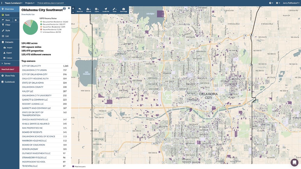
We’ve launched a new way to access  our nationwide dataset of 146 million+ parcels via API for those who want the data in their own apps, but don’t need to host or download it.

There is a 30 day free trial, no payment info required, and after that if you want to continue using the API it’s only $500 - $2,000/month depending on the fields you want access to and the number of API calls.
Full details are at https://landgrid.com/parcel-api


For a license to download and host the data yourself, email us at parcels@landgrid.com.

2. Product & Data Updates:

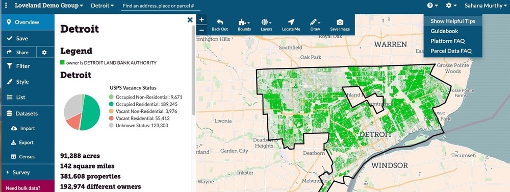
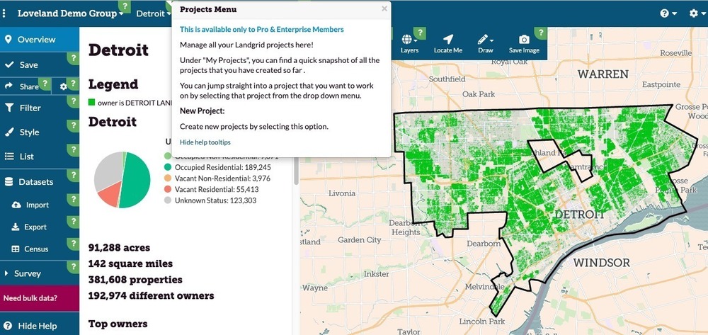
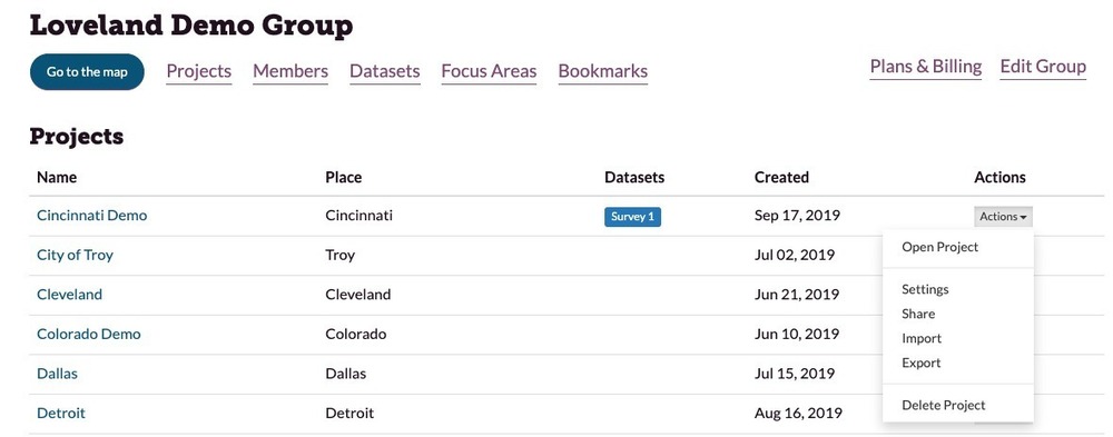
  • Landgrid Pro - For those of you with Pro and Enterprise accounts, we have a lot of great updates on the software side. If you don’t have a Landgrid Pro account yet and you use the site, then come on, it's time to upgrade. They’re only $75/year through the end of December and offer a much better experience: https://landgrid.com/pro. And if you’re trying to push a team project through a Pro account, just drop us a line and we’ll work with you to get you exactly what you need: enterprise@landgrid.com.
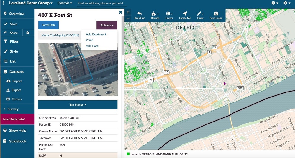
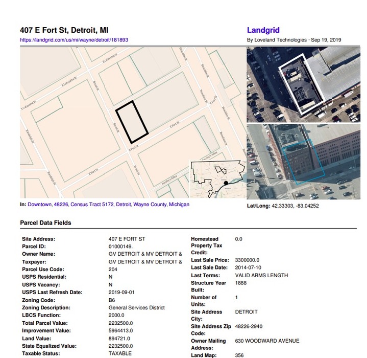
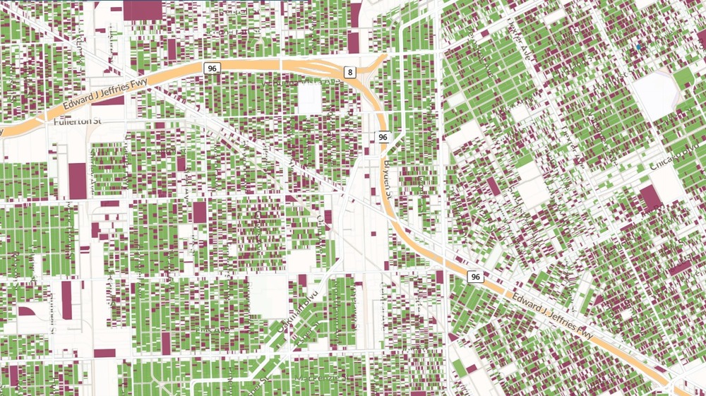
  • Opportunity Zones - You asked and we delivered! We added opportunity zones as columns to our dataset and as a layer to the mapping platform. 
  • Buildings Footprints - Mid November, we are going to launch buildings footprints as a layer on our platform (Pro & above) and we will also append buildings count per parcel to our dataset as a column.
  • Acreage & SQFT columns - We recently added acreage & SQFT of each parcel as columns to our nationwide dataset. You should be able to download this as part of our next parcel update.
  • Landgrid App - We have made so many improvements to our mobile surveying app that listing them would go against our current goal to keep this email short. ;) Check it out. Its free to download - https://landgrid.com/apps
  • Site Control- In December, we will be closing down Sitecontrol.us entirely. Those of you who still use Sitecontrol, we highly recommend that you login into landgrid.com using your Sitecontrol credentials and continue using your account as is. Landgrid.com has all the features that Sitecontrol does, but is augmented with an intuitive & user friendly UI. 


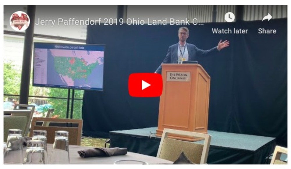
3. People of Landgrid Series :
We launched our first ever customer story with Giancarlo Di Lonardo from New Jersey Community Capital.
Read all about the amazing work Giancarlo & NJCC are doing for NJ communities - https://landgrid.com/pages/people-of-landgrid

Help us tell your story by emailing sahana@landgrid.com

We're sure you are all planning for a solid start to the new year.
Holler & let us know how we or our solutions can help you with your projects & goals. We are just an email away.


Happy Mapping!


October Letter from Loveland’s CEO: Happy Weddings, Vacancy Data, and The Oklahoma Land Rush

By Sahana Murthy on October 10, 2019 · Announcements

Letter from the CEO of Loveland Technologies & landgrid.com

Picking up from my last note about the upcoming wedding, I have happy news to report…

We did it and it was great!

While the building of our marriage is now fully occupied, the theme of the month at Loveland HQ is nationwide vacant property data.

Write to us at parcels@landgrid.com if you're interested in data on vacant properties in your community or nationwide. And thank you to everyone who has already taken us up on our October data discount. 


Last week I presented at the Reclaiming Vacant Properties Conference in Atlanta. I was on a panel with two groups whom we have the pleasure of working with on property surveys and data wrangling: The Hartford Land Bank in Connecticut, and New Jersey Community Capital.

Reclaiming Vacant Properties is a meaningful conference for me. It makes me meditate on our journey of assembling nationwide parcel data, which started in part by getting really good at counting vacant buildings in Detroit. I remember driving overnight from Detroit to Philadelphia for the conference back in 2013. I didn’t have a hotel room so I reclined in the driver’s seat and slept in the parking lot for a few hours before going in. 

For years I’ve listened to people argue over the best way to determine whether or not a property is vacant, and I feel comfortable confirming that the nationwide USPS vacancy data we now provide is THE BEST out-of-the-box dataset for determining both the scale of vacancy in a community and whether or not a particular building is likely vacant. 

If you want to use this data, reach out to us at parcels@landgrid.com and we'll set you up with the best method depending on your needs and use-case.


Lastly, I have a book recommendation. While skimming the airport bookshelves in Chicago, my eyes fell upon a book called Boom Town: The Fantastical Saga of Oklahoma City, Its Chaotic Founding, Its Apocalyptic Weather, Its Purloined Basketball Team, and the Dream of Becoming a World-class Metropolis. The disarming thesis of the book is that Oklahoma City is among the most interesting cities in the country, if not the world. I was in the mood to be convinced of this, and wasn’t disappointed. The book covers much more than the land rush, but as land grid mappers who have seen a lot of strange things, the story of the Oklahoma Land Rush is just too much to actually fathom. At noon on April 22, 1889, people just started running to the land they wanted to own, overlapping and leaving no room for streets — a problem that needed to be solved in the complete absence of government. Of course there were conniving people who had already tried to rig things. Two competing companies pre-planned a layout for downtown Oklahoma City, hiding in the high grass before the rush and essentially just standing up and getting to work at noon. Or something like that. They refused to compromise, and some of the otherwise straight streets of Oklahoma City had strange jogs to connect these incompatible plans.

(Of course I went to try to find them on our Oklahoma City map, but it looks like they’ve mostly since been corrected. I did however learn that Oklahoma City Southwest has 6,331 vacant buildings according to the USPS data, so, you know, score.)

If you’re into American history, the development of cities, and/or looking for new and exciting ways to put your family to sleep this Thanksgiving, I recommend Boom Town. It really is interesting and well written, and it opens up into a beautiful mediation on this strange world we all live in, and the contradictions and coincidences and crazy characters that coalesce into civilization.

Jerry Paffendorf
908-343-1981

CEO, LOVELAND Technologies
http://landgrid.com

407 E Fort St, Suite 100
Detroit, MI 48226


October Discount on Vacant Property Data & More - Fall 2019!

By Sahana Murthy on September 30, 2019 · Announcements

Fall 2019 is here! Don’t worry - this is not the fashion edition. ;)

We are just excited to kickstart the fall and holiday season with some amazing product updates and some deep discounts to our customers! 

Landgrid Fall Discounts! 
We know , We know… Enough talk of the Fall Season! Let’s get to the interesting stuff - October Discounts, Was It???
Announcing the Landgrid Fall Promotions: October 2019 

1. Landgrid Pro: $75   
From today, October 1st, through the end of the year, annual Pro accounts are only $75/Year. With the addition of more data (USPS, Opportunity zones etc) for Pro customers plus our user-friendly mapping tools, it’s time to get off the fence and become a Landgrid Pro member in 2019. Get a Pro account here.

  • Why are we doing this you ask???
  • To make the amazing & powerful USPS vacancy data accessible to you on your Pro subscription. Also so you can make the most out of our mapping platform without restrictions.
  • Monthly pricing still remains at $10/month, if you choose a monthly subscription.
  • To avail this offer, go to https://landgrid.com/plans and choose Pro, annual subscription!

USPS Discounts: (Only through October)
Through the end of October only we are offering a discount on our exportable US Postal Service vacancy and residential property data for both national and locally focused customers.

Jerry, our CEO, will be presenting at the big Reclaiming Vacant Properties Conference in Atlanta this week, so these are timely deals.


2. Local USPS offer: $2500

  • If you want unrestricted use of the USPS data within your county, only $2,500 will allow you to export spreadsheets containing the vacancy and residential property data for your county for one year. This is a great upgrade to Enterprise - Team for Pro users who want to export the USPS data from their account, and a great way in for organizations who want to do the same.
  • Don’t wait. Take advantage of this offer to get a huge jump on understanding and managing the scale of vacancy in your community.
  • This offer is valid only till the end of October. So grab it before it ends by emailing us at enterprise@landgrid.com
  • Note - Existing Enterprise customers already have this option, plus additional services.
  1. National USPS offer: $10,000  
    (For existing & new data customers)
  • If you want nationwide access to the USPS data, we are offering access to nationwide spreadsheets or the additional USPS columns added to your current parcel data license for only $10,000 for one year.
  • This is a great deal for people who need lists of property information in multiple communities apart from parcel data, and for parcel data customers who want the USPS columns added to their parcels. 

We will only be running the USPS deal through the end of October so please write to us at parcels@landgrid.com to claim your spot. Yes, we can be a little lenient if you need to budget or move funds around, but only if you confirm your intent to purchase the USPS data within the month of October. Just like parcel boundaries, lines must be drawn!


Landgrid Product & Data Updates
As you know from our recent updates and announcements, we have been amping up our product suite BIG TIME.

For the uninitiated, here’s a quick recap of what we have added recently and what we are currently adding to our products:

  1. Nationwide USPS vacancy & residential data to our parcel dataset & the mapping platform.
  2. We also just added nationwide opportunity zones to our dataset & mapping platform. You can find them at both parcel level & as a map layer on the mapping platform if you have a Pro and above subscription.
  3. We are currently in the process of adding nationwide Building Footprints, along with normalized zoning codes - where - you guessed it - Nationwide!
  4. We improved the map UI to make it easier to use and we amped it up a bunch of helpful tips, available on demand at all times for you.
  5. We made each individual parcel record printable into PDF’s. You can now notarize each survey record by printing it as a PDF if that’s important in your line of work.
  6. Landgrid App - If its been awhile since you used the Landgrid survey app, now is the time to check it out. New UI, better functionality & improved performance is what you will find! Oh also, we changed the name from the Loveland Next app to the easy peezy Landgrid App. Surveying &/or looking up parcels on the go has never been easier.

You can read all about our recent product developments on this blog here.

People of Landgrid!
Some of you may have seen our email from last week about a new customer focused series that we want to start soon called the - People of Landgrid!

You know, we love our customers!
And we want to celebrate YOU!
Each month, we would love to tell your story - What goals you accomplish, how your work is making a difference in your field & industry etc.

You - The People of Landgrid make us better as a company!
Help us tell your stories better! Join us in our people of landgrid series!

Email sahana@landgrid.com and she will get in touch with you to schedule a time to talk more about you and the work you do.

Checkout the full update from last week here - https://mailchi.mp/makeloveland/people-of-landgrid-help-us-celebrate-you


Jerry’s Keynote at the OH Land Bank Conference!

The OLB Conference is an annual meeting of land banks that convene from all over Ohio to learn about best practices and policy changes that directly affect their work - hosted by our partners at the Western Reserve Land Conservancy - https://www.wrlandconservancy.org/olbc2019/

Watch Jerry's keynote from the event, about all things Loveland, Landgrid Products, and the incredible USPS vacancy data:


Its conference season!
Jerry is also speaking at the panel this week at the Center for Community Progress’ Reclaiming Vacant Property Conference in Atlanta. If you are attending the RVP this year, please let us know. Jerry, Nick & Sahana from our team will be there and they would love the opportunity to catch up with you!

Well, that brings us to the end of the October Newsletter!
Stay tuned with us for announcements on building footprints & other updates! We are cracking away to close the year on a high note! 

Please make the most out of this amazing, albeit short lived Fall weather and might we add - please make the most out of our Fall promotions!
Let us know if you are interested in taking us up on any of the above discounts. Just holler at team@landgrid.com. You know we are a super friendly team and we will get in touch with you right away!.

Until then, enjoy some yummy fall soups & halloween candies!

Happy October!


Better Help Tools, Better Features, Better Data & Better Landgrid.com

By Sahana Murthy on September 19, 2019 · How-To

Howdy people of Landgrid & soon to be people of Landgrid!

If you have been following us these past few months, you know that we have been adding lots of improvements & new functionality to our suite of products.

Our most recent updates were the USPS - Vacancy & residential data that we added both to our bulk parcel dataset & to our Landgrid Mapping Platform.

Along the lines of making our platform better & easier to use & navigate, we recently conducted a UX study with a host of new users, power users & GIS users to understand how usable our product is.

A direct result of that are the new help tools to navigate & manage your projects better on the Landgrid platform. We have always had help tools & documentation on our platform. 

But with these tooltips, we want to take things a step further to make your experience go smoother on the platform. We essentially want to make sure that you have the tools you need to make the most out of our fully loaded site & mainly so you never feel lost on how to use the platform.

The best thing about these help tools are that they are available to you, at all times on demand! You can toggle to turn them on when you need help navigating the site & turn them when you don’t.

Apart from the help tools, we have added some other functionality into the platform that are also a direct result of us listening to our customers. We took many of your requests and incorporated some of there here. I know there are many more requests & rest assured - We will get to them & add those to our product roadmap in the coming months.

So here’s a quick snapshot into everything that we have added to the platform to make it more usable:

1. Onboarding Tooltips:

  • To turn on tooltips, you can select “Show Help” on the left hand panel or under the “?” icon drop down and it will instantly bring up the tips for each of our many features. 

  • Click on the “?” on the tip and it will open up a window describing the feature to you, along with links to the relevant articles on our product documentation for a deeper dive into the feature.

  • To turn the tooltips off, simple select “Hide Help” on the left hand panel, or on the tooltip window itself or under the “?” drop down. 
  • OR Simple press the escape key “esc” on your keyboard to exit the help tools.


2. Project Settings:

  • We heard you! We’ve had users asking for an easy way to manage & edit projects from one central location. You can now do that from your dashboard page.
  • Select “Actions” drop down as shown below and you should be able to edit project settings, delete, import or export straight from the Dashboard.
  • We also added “Date Created” and datasets associated with your project to your dashboard. So now you can see all the details that you need to know about your projects right here

3. Printable PDF’s of parcel page & attributes:

  • We work with a lot of landbanks & municipalities and they have been asking us to build a way to print individual parcel records or survey records  as PDF’s.
  • And now its available on Landgrid.com!
  • How to access it, you ask? Easy - Navigate & zoom into the parcel you want to print.
  • When the parcel page loads up, click on the “Actions” dropdown and you will see 3 options there:
    • Bookmark - Which is now part of the dropdown.
    • Print - To print the entire parcel record as a PDF
    • Add Post - If your project is part of a survey, you can use the “Add Post” function to update the information for this parcel.

        The resulting Parcel PDF looks like this:

4. Few other improvements:

  • We are in the process of adding building footprints to our data & as a map layer on our platform. We want to give you a teaser of what that would look like. For Pro & above users, go to “Layers” & select Ohio Buildings and you can see the building footprints render on the map. Soon we will have this available nationwide.
  • “Esc” key can be used to turn off some of our other features as well - like the draw & measure tool. This was a request from one of our users & we made it happen.
  • Better accessibility on the platform - Turning on & off of layers & bounds is more intuitive & usable now. 

Well… That’s a lot of work & improvements from our team. Kudos to our amazing CTO Larry Sheradon & our data team for keeping us on our toes & making sure that we are constantly improving! 

We are not done yet! There is more coming in 2019 & stay tuned with us to learn more!