By Sahana Murthy
on January 14, 2020
· Announcements

Happy New Year!
The Loveland team had our best year yet in 2019, defined by number of people visiting the site, number of new customers, growth of our dataset, size of our project pipeline, and just overall momentum and enthusiasm for the future.
Part of our success comes from being very accessible and friendly as a team, with an open door policy for contacting any of us, and a desire to hear what you’re trying to accomplish and discuss how we can assist.
In that spirit, this letter is a personal invitation for you to contact me at jerry@landgrid.com if you think our data or software may be a fit for your organization or project and want to talk about it.

I know that sometimes not having a direct invitation or a specific person to contact can be a hindrance to reaching out, so let’s get that out of the way. Lay it on me.
I’ll read and reply to everything personally, and connect you with the right person on the team as appropriate. I promise you a friendly and easy experience seeing if there’s a fit.
Here’s a quick refresher and links to our two main services:
Enterprise Software:
If your organization is using lots of property and spatial data for a project or as a part of your core operations, and you need it all tamed, refreshed, and loaded into a slick interface where you can instantly search it, sort it, and put it to work, holler at me about our Enterprise software solutions.
https://landgrid.com/enterprise
Parcel Data Licensing:
If your organization already has a mapping system and you’re looking for more data for your team or your customers, ask me about our nationwide parcel data, including ownership and assessment info, nationwide vacancy, building counts, and land use fields.
https://landgrid.com/parcels
All the best from our team. I look forward to connecting with you soon and doing everything I can to make 2020 a great year for both of us.
Happy Mapping!
Jerry Paffendorf
jerry@landgrid.com
By Sahana Murthy
on January 9, 2020
· How-To

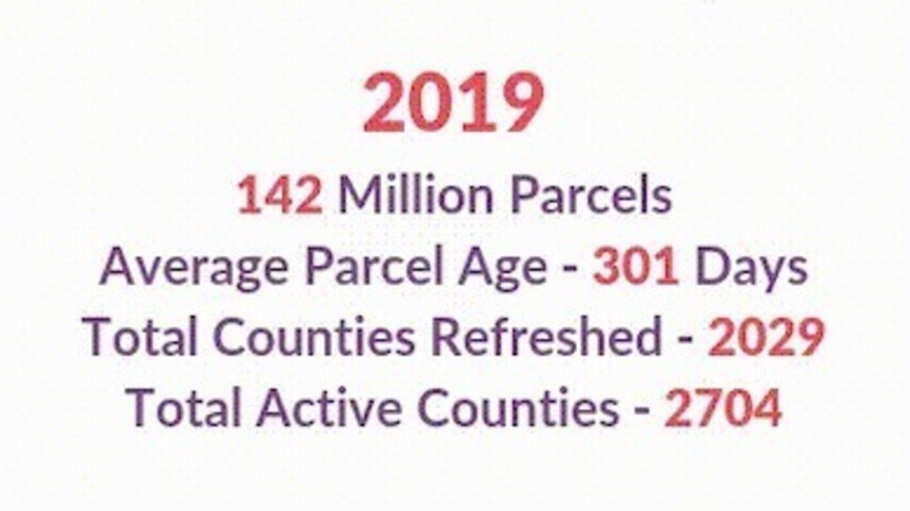
As of end of 2019, Loveland has aggregated 142 million parcels nationwide, all of which is meticulously mapped on the Landgrid Mapping Platform.
Not just that:
We refreshed - 2029 counties
We have a total of - 2704 counties &
Best of all, our total average parcel age/currency is under a year right now!
Oh and how can I forget - We added the coveted USPS residential and vacancy indicators to our data.

But enough about the data we have!
Let’s talk about YOUR Data!!!
In today’s time, we know that everyone has & wants to work with their own datasets. You’ve spent years perhaps collecting the property data that you use for your day to day work - whether you are a county, Landbank, university, mapping company or operate in real estate,
As a data company, we value ALL data.
So, Bring your own data to us and we will manage it and put it all up in one central location - Be it your own massive or small property dataset, mortgage data , census tract data or data that you may have collected using property & land surveys.
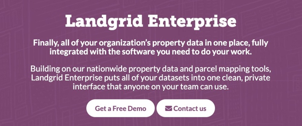
Landgrid Enterprise - Finally, all of your organization’s property data in one place, fully integrated with the software you need to do your work.
https://landgrid.com/enterprise
No matter the size & scale of your data - leave it to the Loveland team to manage & import it for you.
Doesn’t matter how your data is structured - whether its in one consolidated DB or in multiple siloes.
We can handle it. We will clean it, standardize it, even geocode it if necessary and add it on to the Landgrid platform under your account.
And voila --- you & your entire can visualize your data, build beautiful color coded maps and augment your data with unlimited land surveys straight out of your Enterprise account.
Couple that with custom capabilities and you have the dream property management solution that you never knew existed.
What do we mean by custom solutions:
Could be anything ranging from as small as :
- custom reports
- to custom filters
- to custom data stats derived specifically for you, tailored to your analytic needs
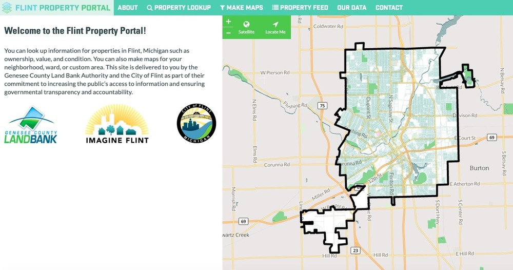
- to an entirely custom site built just for you with your branding with embedded & interactive maps. Here’s an example of a made from scratch custom site that we built in partnership with the City of Flint & the Genessee county - https://flintpropertyportal.com/

Sky’s the limit.
Don’t worry about the scale of your project either.
Got an idea or need for an easy to use parcel data solution (No prior GIS experience required)???
Email us at enterprise@landgrid.com .
We can do a quick demo and get you a sense of what your solution could be - tailored just you.
Doesn’t get better than this.
Lets handle your property data for you and make your life easy! How’s that for a 2020 resolution???
We look forward to hearing from you!
Enterprise Team!
Sahana Murthy
By Sahana Murthy
on December 9, 2019
· Announcements


As we head into the holidays and the new year — 2020, eek! — here’s what’s new and what to know:
1. New 2020 Parcel Pricing -
Our CEO - Jerry Paffendorf announced this last month in the November Letter from the CEO. Starting January, 2020 we will be raising our parcel licensing prices.
This new pricing does NOT affect our existing customers and those who buy from us by the end of the year will be grandfathered in as well.
If you want access to nationwide parcel data for your own app or database, contact us at parcels@landgrid.com today to lock in 2019 pricing into the future.
2. End of the Year Pro Account Discount -
You can grab a Pro account for only $75/year if you sign up here before the end of December. Look out for even more data coming to Pro accounts soon, including nationwide building footprints in January.
3. Goodbye Sitecontrol -
This December, we will be finally closing down sitecontrol.us. While some of you aren’t familiar with the old name, what we call the Landgrid mapping platform today used to be called Sitecontrol.us previously. Post rebranding, we have been navigating and urging all of our users to fully transition to landgrid.com.
Don’t fret. We have retained all of Sitecontrol’s features and made the UI even better and easier to use with landgrid.com. So all you have to do is use your Sitecontrol login credentials to login into landgrid.com and you will be on your way to making beautiful maps and comprehensive surveys. Better UI with all the benefits of Sitecontrol!
4. People of Landgrid - Dr. Stephen Sills!
If you are looking for an inspiring quick read on how to use parcel data to accomplish great and interesting things, look no further: https://landgrid.com/pages/stephen-sills
Stephen Sills, Professor of Sociology at the University of North Carolina, Greensboro & the Director of Center for Housing & Community Studies.
Dr.Sills has focused his research work on core issues such as global migration, immigration, and social support networks for marginalized people.
As the Director of UNCG Center for Housing and Community Studies (CHCS), he and his team are committed to understanding the impediments to fair housing, continuum of care for the homeless & the impact of housing on health.
A long time Landgrid platform user, Dr.Sills has used Landgrid for various projects - from documenting the conditions of housing in a few specific neighborhoods to using the "blexting" app, then in a remote assessment of nearly 16,000 parcels in High Point, NC, and more recently in projects using our own survey instruments and remote assessment in Greensboro (78,000 parcels), and Rocky Mount (3,500 parcels).
So proud of all the great work that Dr. Sills and the CHCS are doing.

With that, we want to THANK YOU for all the support and love you have given us this year and hope that we’re blessed to receive the same in the coming years as well.
Happy Holidays - We wish you happiness and merriment with your loved ones this Christmas, Hanukkah, Kwanzaa, or however you celebrate the season.
We will meet again in 2020. Watch out for bigger and better product updates next year!
As always, we are just an email away. Feel free to email us at team@landgrid.com if you have any questions or updates for us.
Happy Mapping!
Team Loveland.
By Sahana Murthy
on November 18, 2019
· Announcements

This update is of primary interest to those who license our bulk parcel data or are interested in licensing our bulk parcel data as we are raising the price of our nationwide parcel dataset from $25,000/year to $35,000/year on January 1st. This increase will not affect existing customers or customers who join before then.
Our software customers and website users will also find this message interesting in that our underlying data is outstanding and keeps improving.
Jumping in: It’s been a good year.
2019 saw dozens of new companies and research projects license our nationwide parcel data to power applications spanning climate, insurance, energy, agriculture, transportation, conservation, outdoor recreation, and other domains that touch property, housing, and the landscape.
Our team is rocking it on new coverage, new data fields, improved update frequency, more seamless delivery, and everything it takes to not only provide great data, but a great, friendly, and reliable service.
I think it’s fair to say we are the most affordable provider of high quality parcel data by a long shot. People are constantly surprised when they find us. “How’d you do this and where have you been??”
This makes us very, very happy.
To reflect continued improvements in the data and to allow us to invest even more into it, on January 1st, 2020 we’re raising our core nationwide data licensing prices from $25,000/year to $35,000/year.
The vacant buildings dataset and the new buildings count dataset (which can be used to identify both structures and vacant land) will also increase slightly.
This, however, will not affect our current customers, nor will it affect customers who sign up before the end of the year. Everyone in before January 1 will keep their current price, and will be grandfathered into renewing at their current price in the future.
That means if you’ve been on the fence about licensing our data, it’s a really good time. Write to us today at parcels@landgrid.com to claim the 2019 prices into the future.
As we continue to transition from relative newcomer to the recognized leader in providing parcel data, we will always keep our prices more affordable and our terms more friendly than other suppliers. It’s in our nature as people who believe that knowledge of the land grid is fundamental.
On that note, also check out our API offering if you want to add parcel data to your app, but don’t need to download the whole enchilada: https://landgrid.com/parcel-api.
A very happy Holiday Season to you and yours from our team! Let’s all go into 2020 strong.
Happy Mapping!
Jerry Paffendorf
CEO & Co-Founder


